Watch a demo
How 3D mapping is revolutionizing renewable energy and engineering
3D mapping is giving developers new capabilities in optimizing energy installations. Use the new 3D feature in RatedPower to plan your next solar project.


Laura Rodríguez
Territory Manager Oceania & Nordics
Laura is a renewable and software industry sales professional, currently working at RatedPower as Territory Manager Oceania & Nordics. With a background in International Business and International Trade, Laura previously worked in the business strategy area in various companies as well as as a market analyst for the Government of Spain in Australia.

Content
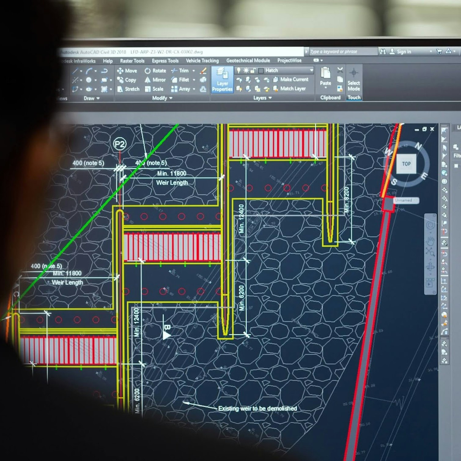
As a solar developer, you need accurate calculations to devise the most efficient photovoltaic (PV) panel installations. Digitalization in the solar industry is bringing developers new data capabilities including the use of building information modeling (BIM) technology, which has evolved to become a valuable analytical method for planning complex engineering designs.
BIM collates visuals and measurements in a computer model to help engineers, architects, and builders to design and manage infrastructure developments with precise data. The use of intelligent modeling gives industry professionals a realistic view of a site to get a handle on project feasibility, costs, and scheduling.

3D mapping and Building Information Modeling
BIM incorporates three-dimensional (3D) mapping, a machine vision technology that can profile objects in 3D to map them in real-world scenarios. 3D mapping allows engineers to visualize all the elements of a project, such as a renewable energy site.
In the solar PV sector, designers can use 3D tools to plan the layout of solar panels on rooftops or ground-level sites. They can create models for installations based on details such as building height, roof shape or pitch.
The use of 3D mapping not only shows how a solar panel installation will look but how shadows will move over the site during a day, so that designers can come up with an optimal design that makes the most efficient use of the space.
Such detailed visualization speeds up the design process and identifies potential hurdles that could appear during the project, so they can be dealt with in advance. And digital models have uses far beyond the design stage, as they can be updated to create new simulations for years to come.
Are you a a PV solar who wants to expedite time-to-layout and reduce LCOE? Find out the major must-haves and deal-breakers when comparing solutions for your solar team with this free guide . A handy checklist included!
3D mapping in action
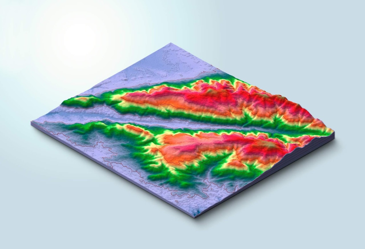
Advances in 3D mapping technology are taking the lead in carrying out difficult engineering designs. While mapping locations using images taken from aircraft or satellites is not new, 3D techniques create enhanced models that are revolutionizing a number of industries.
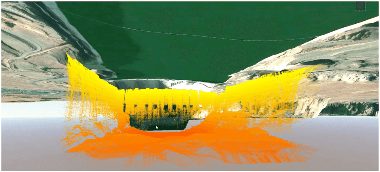
An example of 3D modeling in action is the Glen Canyon Dam in Arizona, US, where the Bureau of Reclamation built a 3D technical model of the dam incorporating old 2D drawings with images from lidar scanners, sonar and cameras. The comprehensive model includes details of the canyon walls, reservoir and river areas, as well as the power plant.
The bureau added real-time data about the dam’s operation to the model to create a dynamic, virtual view for operators to monitor the health of the facilities, identify risks that need addressing, diagnose and repair damage and project future performance. Similar models can also be used at aging power plants, ports, bridges, and other infrastructure.

There are different types of 3D mapping, including drone mapping, geographic information system (GIS mapping), and 3D projection, or video, mapping.
Drone mapping
Remotely controlled drones are increasingly being used to create 3D maps because they can fly at lower altitudes with tighter control than aircraft to capture high-quality images and data. And drones fitted with Light Detection and Ranging (LiDAR) remote sensor technology use laser pulses to collect measurements that enhance surveying for site work.
Drones are being deployed in the energy industry for modeling construction projects, as well as for site preparation, installation, and maintenance. Drones can also inspect power lines, transmission masts, pipelines, and wind turbines as well as solar PV panels, building facades, and roof composition.
3D drone mapping has an especially cool application: NASA’s Lunar Reconnaissance Orbiter (LRO), which has been orbiting the moon since 2009, has produced a 3D map of the moon’s surface as a tool for NASA’s Scientific Visualization Studio. NASA has released the mapping data publicly in its CGI Moon Kit, which designers can use in 3D animation software to create authentic imagery.


GIS mapping
Two dimensional (2D) GIS mapping first emerged in the 1960s with the development of computers to depict locations. 3D technology allows maps to include elevation data for more detailed visualizations and analysis.
For example, the London Solar Opportunity Map was launched in 2020 by the Building Stock Laboratory at UCL Energy Institute for the Greater London Authority. The online mapping tool uses elevation data from the Environment Agency to create a 3D model of all buildings, open spaces, trees, and hills in the 33 London boroughs to estimate the potential for PV panel installations.
The tool incorporates LiDAR data from aircraft to calculate the amount of solar radiation that falls annually on all rooftops and land areas. In doing so, it helps property owners, solar companies, as well as local governments, estimate the potential for PV panels and solar thermal installations on buildings and land in London.
Projection mapping
3D projection mapping, also known as video mapping, uses spaces and objects as the surface to display visualizations instead of on a 2D screen. By projecting data and site imagery in a 3D format, developers can gain a new perspective on a design and identify opportunities and challenges that might not be so evident from a 2D representation.
In the United Arab Emirates, the Ministry of Environment and Water used projection mapping on 3D objects in a dark room to raise awareness of the country’s energy and water consumption and visualize potential ways to advance environmental sustainability.


Use RatedPower's 3D mapping tool to optimize solar projects
The growing adoption of 3D mapping functionality is especially timely as it can help engineers to design projects remotely. Look out for the 3D layout option of RatedPower for solar plant design and engineering. And if you like what you see, request a demo with our team of experts, which will answer your questions and show you our platform first-hand.
Read the full 2026 Solar Trends Report!
Explore the key renewable energy trends shaping 2026 — from grid constraints and hybrid solar to storage, digitalization, and shifting regional markets.


Latest stories
Related posts
Technology and engineering
How 3D Planning Is Accelerating Solar Deployment in Finland
Find out how 3D solar design and digital permitting are transforming Finland’s energy development, streamlining workflows, and ensuring regulatory compliance.
Updated 24 MAR, 26

Technology and engineering
Outsmarting congestion: How efficient solar design helps navigate Nordic grid limits
Learn how Nordic operators and solar developers are adjusting to tighter grid conditions and how policy and design decisions are keeping projects on track.
Updated 16 DEC, 25

Technology and engineering
The rise of ultra-thin perovskite solar cells
Learn about Japan’s $1.5B initiative to commercialize ultra-thin, flexible perovskite solar cells and how it could transform the solar landscape globally.
Updated 30 SEP, 25