Watch a demo
How 3D Planning Is Accelerating Solar Deployment in Finland
Find out how 3D solar design and digital permitting are transforming Finland’s energy development, streamlining workflows, and ensuring regulatory compliance.


Laura Rodríguez
Territory Manager Oceania & Nordics
Laura is a renewable and software industry sales professional, currently working at RatedPower as Territory Manager Oceania & Nordics. With a background in International Business and International Trade, Laura previously worked in the business strategy area in various companies as well as as a market analyst for the Government of Spain in Australia.

Content
Finland is not just digitizing building permits, it is restructuring its planning system around structured, machine-readable data. For solar developers, that shift has real implications: faster permitting, clearer zoning compliance, improved grid coordination, and more reliable yield modelling, but only for teams whose workflows align with the country’s emerging digital standards.
Finland’s move toward national 3D city models, interoperable geospatial systems, and the Built Environment Information System (RYTJ) signals a transition from document-based planning to data-driven approval processes. For rooftop, commercial, and utility-scale solar designers, understanding how to integrate into these digital ecosystems is becoming a competitive advantage.
Finland’s move toward digital urban planning
Finland is steadily transforming its urban planning landscape into a digital-first environment. Across cities like Helsinki and Espoo, geospatial tools, open-data platforms, and “smart district” frameworks are changing the game.
The district of Kalasatama in Helsinki is often cited as a smart district testbed, combining detailed 3D city models with open data platforms and energy experimentation. While not all planning decisions occur in real time, the district demonstrates how digital twins, sensor data, and renewable energy integration can coexist within a shared urban data framework. Major innovations include smart grids, shared mobility systems, and the “15-minute city” concept, in which essential services are within a short walk or bike ride.
Take a free product tour of the 3D estimation tool by RatedPower to see how you can run detailed, ray-tracing simulations in under an hour, test design variations, and generate the documentation your stakeholders need without ever leaving the platform.
The role of 3D design in modern permitting
Although BIM (building information modeling) is widely used in Finnish design practices, many permitting processes still rely on document-based submissions rather than fully automated model-checking workflows. The transition toward machine-readable, model-based approvals is ongoing rather than complete.
A Finnish KIRA-digi experiment has shown how BIM can significantly accelerate and streamline the building permit process. Three cities in Finland, Hyvinkää, Järvenpää, and Vantaa, are heading up the project. These cities have tested a new process that uses building information models rather than drawings to apply for residential building permits.
In addition, many Finnish municipalities have adopted an online service called Lupapiste, which facilitates digital interaction between citizens, businesses, and authorities on built environment permissions.
BIM is transforming building control by automating code and data checks through tools like Solibri, helping designers and authorities catch errors early. Inspectors can now review projects in full 3D, verifying fire safety and regulatory compliance visually. By combining BIM with realistic city models enhanced by aerial and laser-scan data, planners can assess how a building fits into its surroundings, its shadows, sightlines, and overall impact.
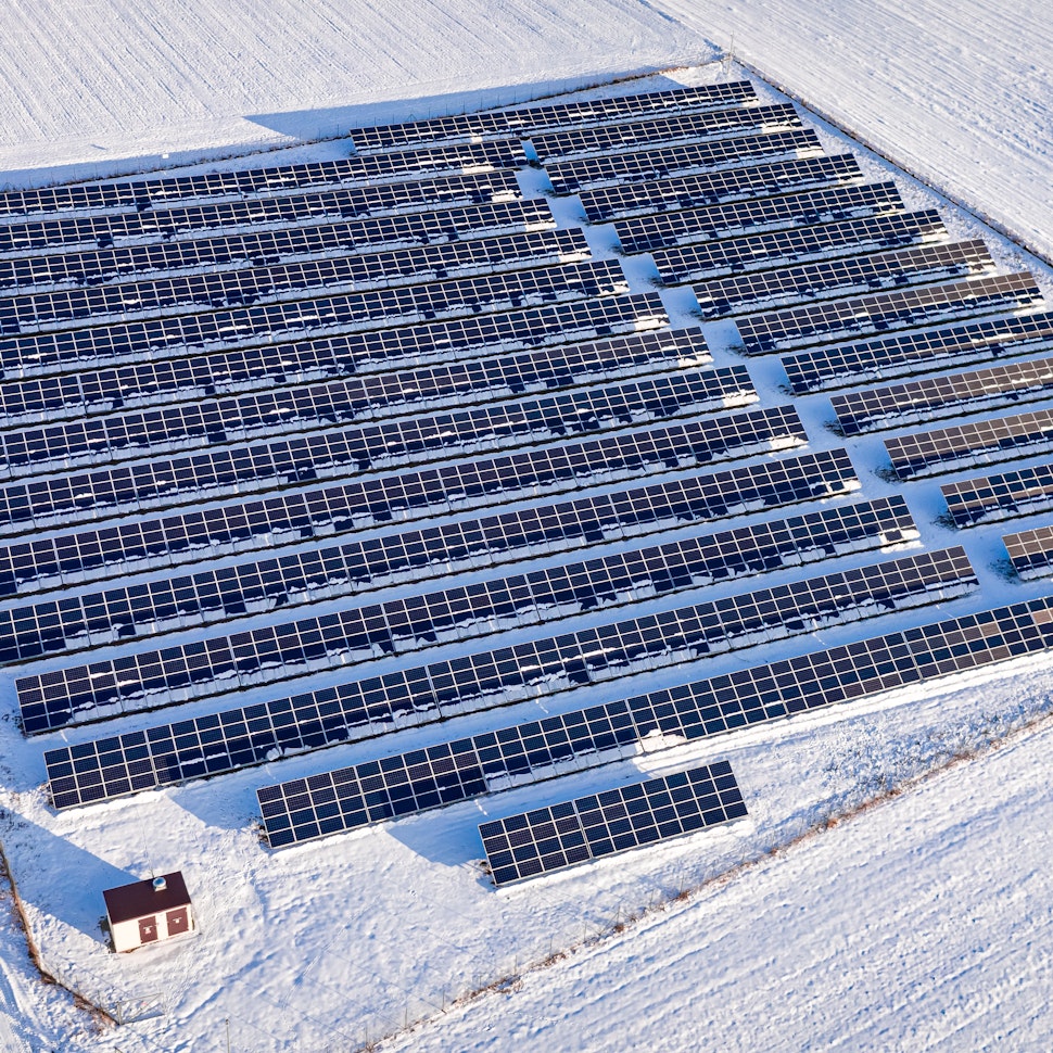
For solar designers, these integrated 3D environments offer far more than visualization. Finland’s northern latitude makes accurate modelling particularly critical: low winter sun angles, long shadow paths, snow accumulation loads, and seasonal irradiance variation can materially affect system sizing and financial modelling. High-resolution terrain data and LiDAR-derived geometries enable precise shading analysis and structural validation before permit submission.
In dense urban areas, 3D models also allow designers to assess visual impact, shading risks, and how they fit into their immediate environment. For utility-scale solar, terrain modelling supports optimized module placement and access road design, all of which can be integrated into machine-readable planning submissions.


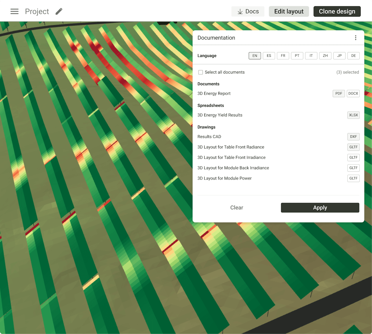
RatedPower's 3D layout feature.
Benefits for energy developers
As Finland tightens its digital planning requirements, 3D design is becoming less about visualization and more about regulatory readiness. For solar developers, model-based workflows can directly influence time-to-permit, financing certainty, and grid approval timelines. Driving this surge is a wave of technological innovation, and 3D building design is paving the way.
This technology is fundamentally reshaping how architects and engineers tackle sustainable construction, delivering a new level of accuracy, efficiency, and design intelligence to every project.
From a solar perspective benefits include:
Yield optimization: 3D solar design enables precise irradiance simulation using accurate terrain and building geometry. Designers can model seasonal production variations, long shadow paths at northern latitudes, and snow coverage impacts before finalizing layouts.
Regulatory compliance: Machine-readable models can be aligned with municipal zoning envelopes, height restrictions, and protected view corridors, reducing the risk of late-stage planning objections.
Grid integration planning: For larger installations, 3D site models can incorporate substation placement, cable routing, and access infrastructure, improving coordination with distribution system operators.
Stakeholder transparency: Interactive 3D visualizations allow municipalities, neighbors, and investors to understand visual impact and land-use implications early, reducing friction during consultation phases.
Navigating Finland’s built environment information system
Finland’s recent legislative overhaul is reshaping built environment information systems and digital planning workflows. Finland is replacing the former Land Use and Building Act with separate legislation, including a new Building Act and the Act on the Built Environment Information System (RYTJ), with a revised Land Use Act to follow.This includes:
The new Building Act (Rakentamislaki), which increases requirements for digital, machine-readable building data.
The Act on the Built Environment Information System (RYTJ), establishing a national digital infrastructure for structured building and real estate data submission.
A forthcoming revised Land Use Act, which will address spatial planning frameworks.
Rather than simply mandating “BIM everywhere,” the reform emphasizes standardized, interoperable data delivery. In practice, this pushes designers toward structured BIM and geospatial workflows that can integrate directly into national databases.
For solar developers, this means that PV layouts, mounting systems, terrain models, substations, and site infrastructure may increasingly need to align with national geospatial standards and machine-readable submission formats. Projects that remain PDF-based may face slower reviews as municipalities modernize their systems.
This means that developers will need to embed BIM workflows from early design, ensure digital models comply with the national data standards defined under RYTJ, and be aware that municipal permitting authorities will increasingly expect machine-readable model data.
Although the system aims to improve consistency and digital connectivity, there are complexities: some commentators have noted that while the reforms strongly emphasize technical data standardization, questions remain about how qualitative design considerations and public participation will integrate into highly structured digital workflows.
For solar developers, aligning with these digital standards will be key to ensuring that PV system layouts and energy models integrate smoothly into national datasets.

Digital-first planning with 3D Energy by RatedPower
As Finland’s permitting and planning frameworks shift toward BIM‑based, machine‑readable workflows, solar developers need design tools that align natively with this new digital reality. The 3D Energy tool by RatedPower supports this transition by combining detailed geospatial data, terrain modeling, and 3D PV layouts into a single, engineer‑ready environment.
By generating accurate energy yield estimates, shading analyses, and fully spatial project layouts early in the development process, developers can ensure their solar designs integrate smoothly with national built environment systems and municipal data requirements.
This digital‑first approach reduces iterative redesign, improves coordination with planners and authorities, and helps position projects for faster review within Finland’s evolving permitting ecosystem.
Take a free product tour to see how you can run detailed, ray-tracing simulations in under an hour, test design variations, and generate the documentation your stakeholders need without ever leaving the platform.
The future of solar‑led urban planning in Finland
Finland is increasingly turning digitalization into a driver of entire city systems. National reports show how electrification, renewable integration, and data‑driven infrastructure are enabling more resilient, low‑carbon built environments. Digital platforms are now being used to monitor energy flows, connect distributed solar generation, and optimize production and consumption across cities.
On the urban planning side, districts such as Kalasatama in Helsinki demonstrate how 3D city models, sensor networks, and citizen co‑creation support the integration of solar generation into broader energy, mobility, and land‑use planning.
In this environment, solar assets are increasingly treated not as isolated installations, but as components of wider urban energy ecosystems. Looking ahead, developers and planners should expect solar projects to plug into interoperable, city‑wide digital ecosystems rather than standalone permit systems. Solar assets are increasingly being treated as connected components of urban energy networks, with performance, grid impact, and long‑term optimization considered from the earliest planning stages.
As Finland’s planning system moves deeper into this digital era, tools like RatedPower help solar developers keep pace with these expectations. By automating complex engineering tasks and producing detailed, data‑driven 3D solar layouts, RatedPower supports more accurate feasibility studies, smoother permitting, and better‑integrated solar projects that align with Finland’s vision for smart, sustainable cities.
Request a live demo today.
Webinar: Mitigating extreme weather risks with advanced data in solar designs
Join Laura Rodriguez (Territory Manager at RatedPower) and Evan Kyte (Product Manager at Clean Power Research) in this webinar to discover how incorporating precise, site-specific irradiance and weather analytics during the preliminary design phase can significantly reduce risks and enhance project performance.

Latest stories
Related posts
Technology and engineering
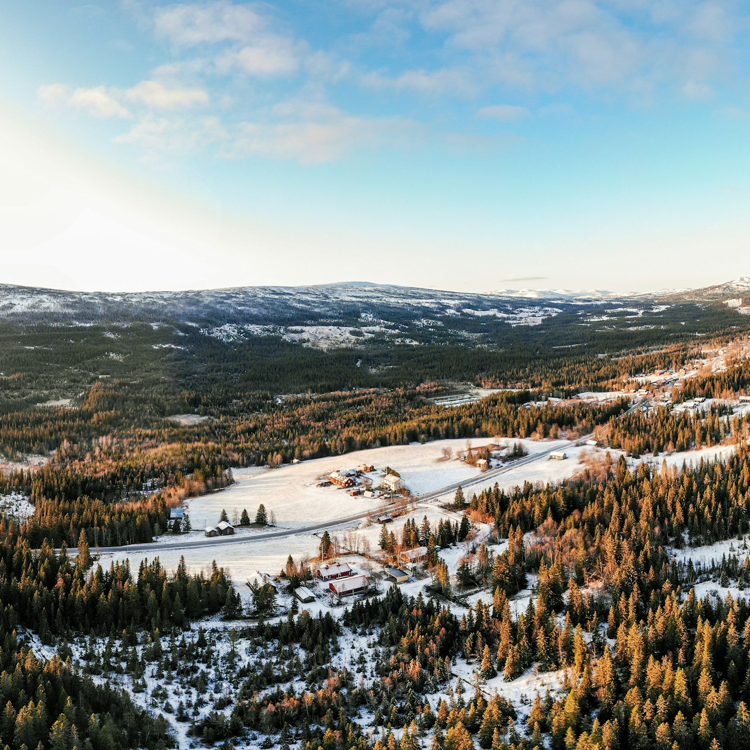
Outsmarting congestion: How efficient solar design helps navigate Nordic grid limits
Learn how Nordic operators and solar developers are adjusting to tighter grid conditions and how policy and design decisions are keeping projects on track.
Updated 16 DEC, 25

Technology and engineering
The rise of ultra-thin perovskite solar cells
Learn about Japan’s $1.5B initiative to commercialize ultra-thin, flexible perovskite solar cells and how it could transform the solar landscape globally.
Updated 30 SEP, 25


Technology and engineering
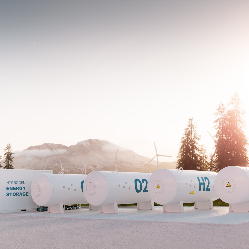
The green hydrogen boom in LatAm
Latin America is emerging as a green hydrogen leader. Learn how LatAm countries are leveraging solar and wind power to drive green hydrogen production.
Updated 22 JUL, 25