Watch a demo
Exploring the RatedPower CAD import tool
Discover the RatedPower CAD import tool, an intuitive and time-saving feature that directly integrates DWG CAD files and shapefiles into our platform.


Pascale Abou Moussa
Product Marketing Manager
Pascale is a marketing expert and Product Marketing Manager at Rated Power. With a background in Neuromarketing, she blends cognitive insights into her strategies. Passionate about understanding the customer needs, Pascale combines her expertise to make impactful contributions to the renewable energy sector.

Content
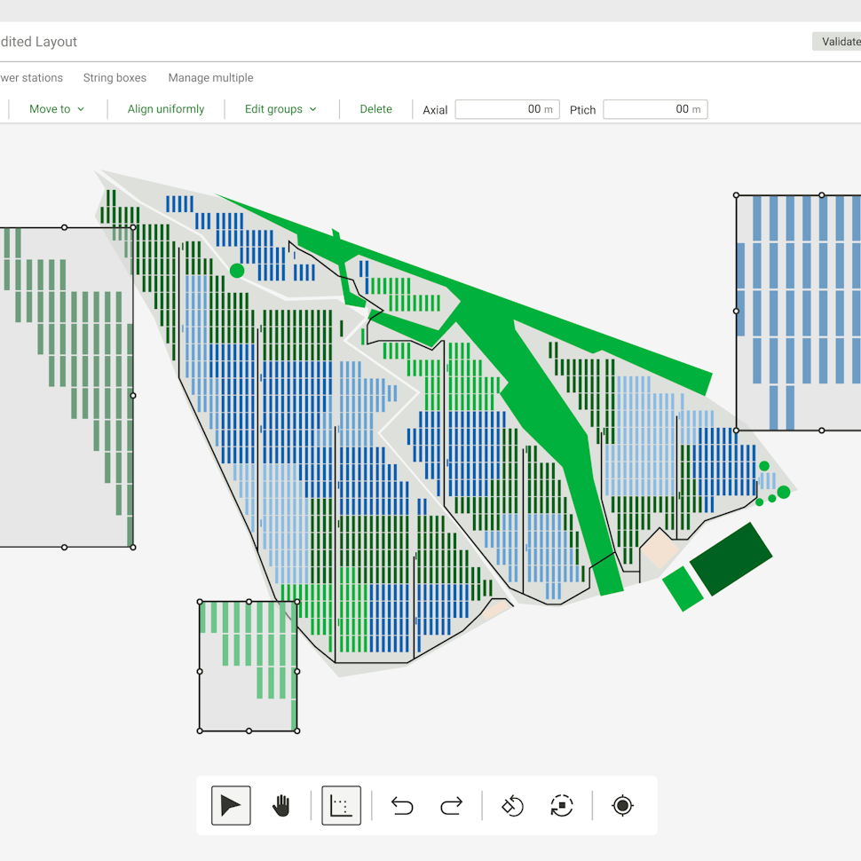
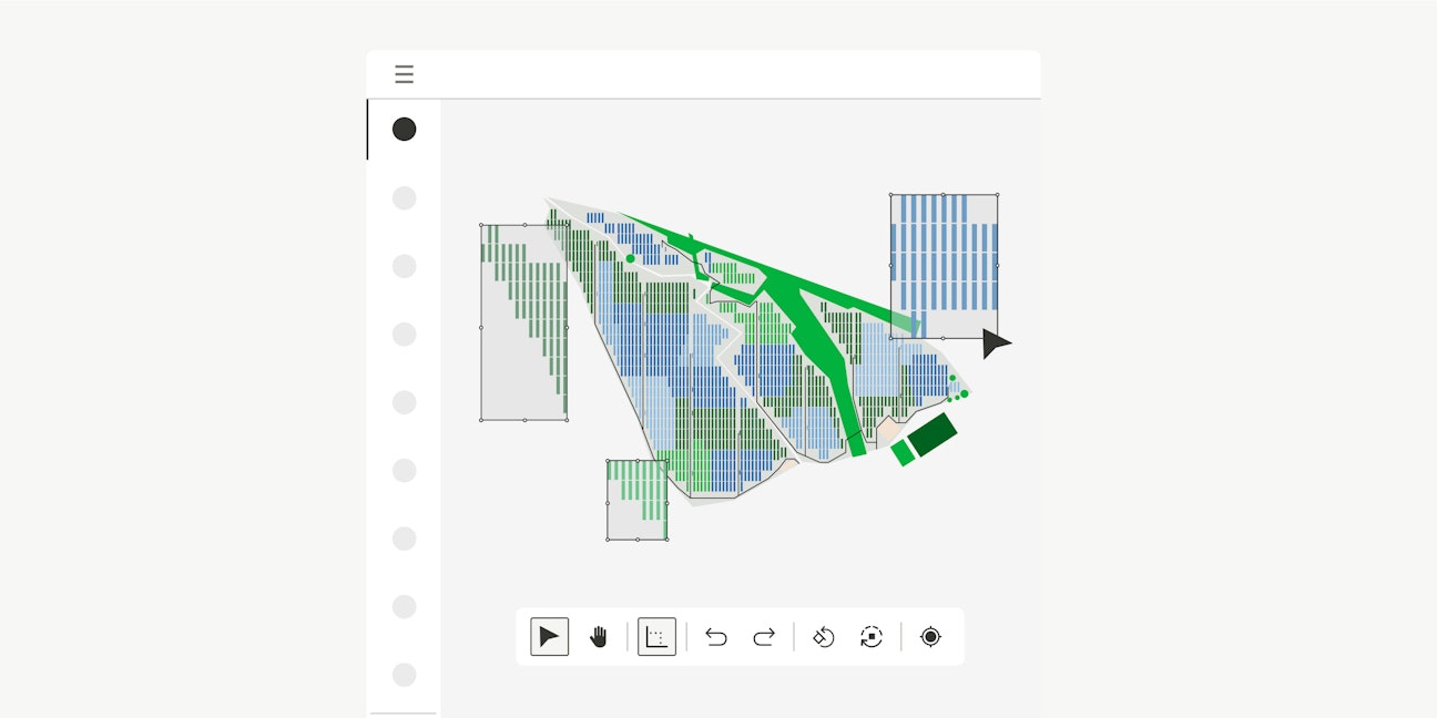
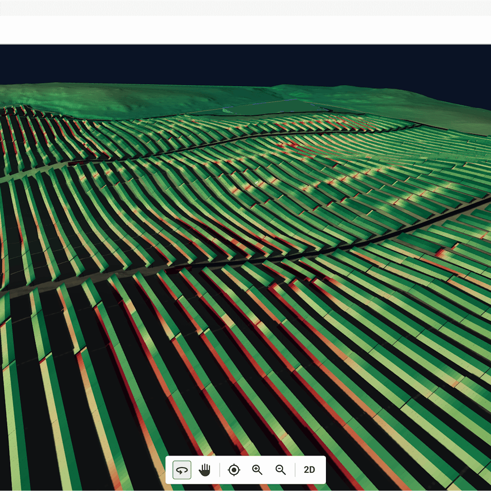
At RatedPower, we’re always building tools to help solar plant designers go from concepts to buildable plans faster than ever.
One such feature is the CAD import tool, an intuitive and time-saving feature that allows you to integrate DWG CAD files and shapefiles directly into our platform. This complements our existing support for KML and KMZ files.
It is a step away from tedious file conversions. Simply import and get to work. Here’s a snapshot of the benefits that stem from this feature:
Import your DWG files directly from AutoCAD.
Say goodbye to inconsistencies. Direct CAD import ensures accurate site alignment and georeferencing while reducing errors from file conversions.
Select the specific layers and elements you need directly within RatedPower once you’ve imported your file. Customize your import and assign site definitions, all within the software.
Watch our webinar to see how to prepare and import your CAD files into RatedPower. We’ve also summarized the steps in this blog to familiarize you with the tool. This new feature is intuitive for both AutoCAD veterans and newcomers, making project file management easy for everyone.
Understanding CRS and EPSG codes
Our CAD import tool automatically and intelligently handles CRS and EPSG codes, two standards that are fundamental to accurate geospatial data analysis.
CRS maps spatial data onto the Earth’s surface using various coordinate systems and projection models. At the same time, EPSG codes serve as the universal standard for identifying and managing different CRSs to keep things consistent across various geospatial datasets and software platforms.
Using the correct CRS and EPSG code ensures that all your site data references the same geographic points. This is crucial for accurate solar site assessments and maintaining geographic accuracy throughout your project.

Preparing and importing CAD Files into RatedPower
Our efficient file import system makes it straightforward to bring your CAD designs into RatedPower.
File preparation
Before importing, make sure that your CAD files meet these format and georeferencing requirements:
Use DWG format for all CAD files.
Georeference your CAD files using a suitable CRS like UTM or NAT to align the site data on the software’s map correctly.
For data integrity, avoid using disconnected lines to represent shapes. For example, a square must be a single closed polygon, not four separate lines.
Follow these tips to optimize your CAD files for import:
Eliminate unnecessary layers and elements.
The file size should not exceed 20 megabytes. Contact us for possible solutions if your files are larger.
To maintain both performance and accuracy during import, limit your files to a maximum of 30 layers, with no more than 500 elements per layer.
The import process
It’s easy to import CAD files:
To start, create a new site in RatedPower and select ‘Import Site Info.’ This opens the import interface where you can select your DWG file.
If your CAD file contains an embedded CRS, RatedPower will automatically detect it. Confirm the detected CRS or choose a different one from the available options.
If your CAD file does not have an embedded CRS, you’ll need to enter the CRS name or EPSG code manually.
After confirming the CRS, you’ll see a list of layers (with their original names) in the sidebar. Select the layers you want to import.
As you select each layer, its elements will be highlighted on the map so you can easily see what you’re importing.
Element configuration and site setup
Once you’ve selected your layers, you can configure the elements and set up your site:
Assign a site definition to each element according to its purpose (substation, restricted area, etc.). This will help you organize your site data efficiently.
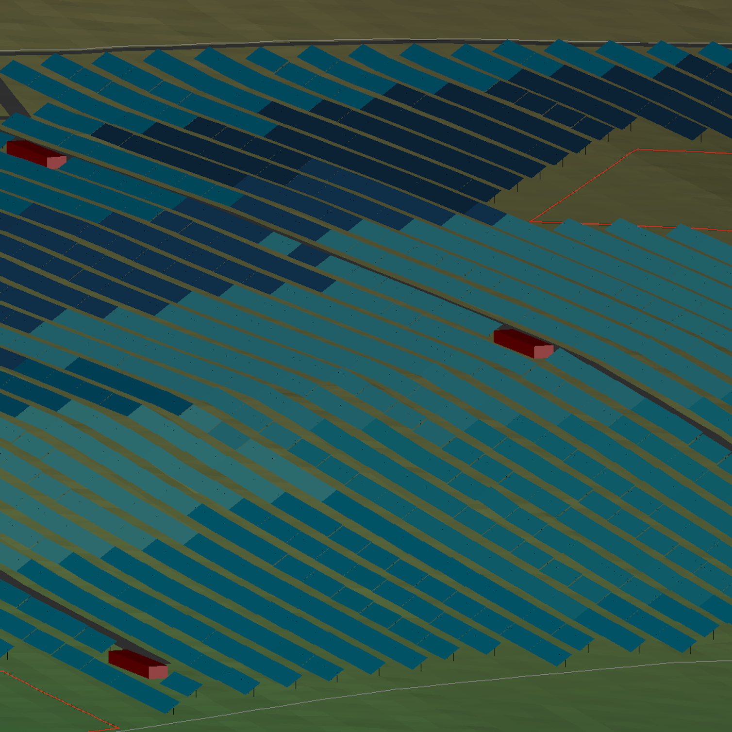
Double-click any element to zoom in on it on the map. This makes it easy to verify placement and make any necessary adjustments.
After importing the layers and tagging the elements, add the necessary site components. Define access points and voltage points for each area.
After correctly placing and defining all elements, save and upload the site to the RatedPower project database to complete the import process.

Advanced features
Layout and CRS updates
You can choose between two alignment methods for your exported project layouts: Geographic Coordinate System and Document CRS.
Select Geographic Coordinate System if you need to align your exports to true north. This setting accounts for the Earth’s curvature and causes your layouts to appear slightly rotated, but it represents geographical directions accurately.
Select Document CRS if you want to align project elements parallel or perpendicular to the AutoCAD grid for presentation purposes, as it keeps project elements neatly aligned with the AutoCAD grid.
To choose the specific CRS for your exported documents, go to the Document Preferences within the Settings tab. Here, you can select any internationally recognized CRS that meets the required standards and units. RatedPower will then apply this chosen CRS setting to all exported project documents, including terrain XYZ data, structure profiles, and the general layout.
Exclusion zone management
The CAD import tool maintains layer names, allowing you to differentiate between various exclusion zones in your DWG files. However, RatedPower does not yet allow users to set different setback configurations directly through CAD imports.
You’ll need to use KML or KMZ files to apply specific setback values and configurations. We’re working on adding direct CAD support for exclusion zone configuration.
Contour lines
To import contour lines, convert them to CSV, XYZ, or TXT format. Direct CAD import for contour lines is under development and will be available in a future update.
Setback configurations
RatedPower also lets you adjust setbacks from structures to restricted areas and roads, giving you better control over your project’s interaction with site constraints.
Let us know what you think!
Your feedback helps us enhance and expand our offerings, so we invite you to integrate these tools into your workflows and share your experiences. Don’t hesitate to contact us at support@ratedpower.com with any questions or for additional support.
Latest stories
Related posts
Product and corporate updates
Revolutionizing PV plant design: The power of 3D energy simulation
Discover how RatedPower’s 3D Energy simulation tool transforms PV plant design by moving beyond flat terrain assumptions to comprehensive 3D analysis.
Updated 10 FEB, 26

Product and corporate updates
Enverus’ Solar ROI calculator: assess PV plant’s profitability
Find out how much you could save by integrating Enverus tools into your solar design workflow, as we explain how our solar ROI calculator works.
Updated 5 AUG, 25


Product and corporate updates
Discover RatedPower’s Layout Editor
RatedPower’s Layout Editor combines precision, automation, and instant feedback to create a financially and commercially viable layout for a PV plant.
Updated 6 MAY, 25